
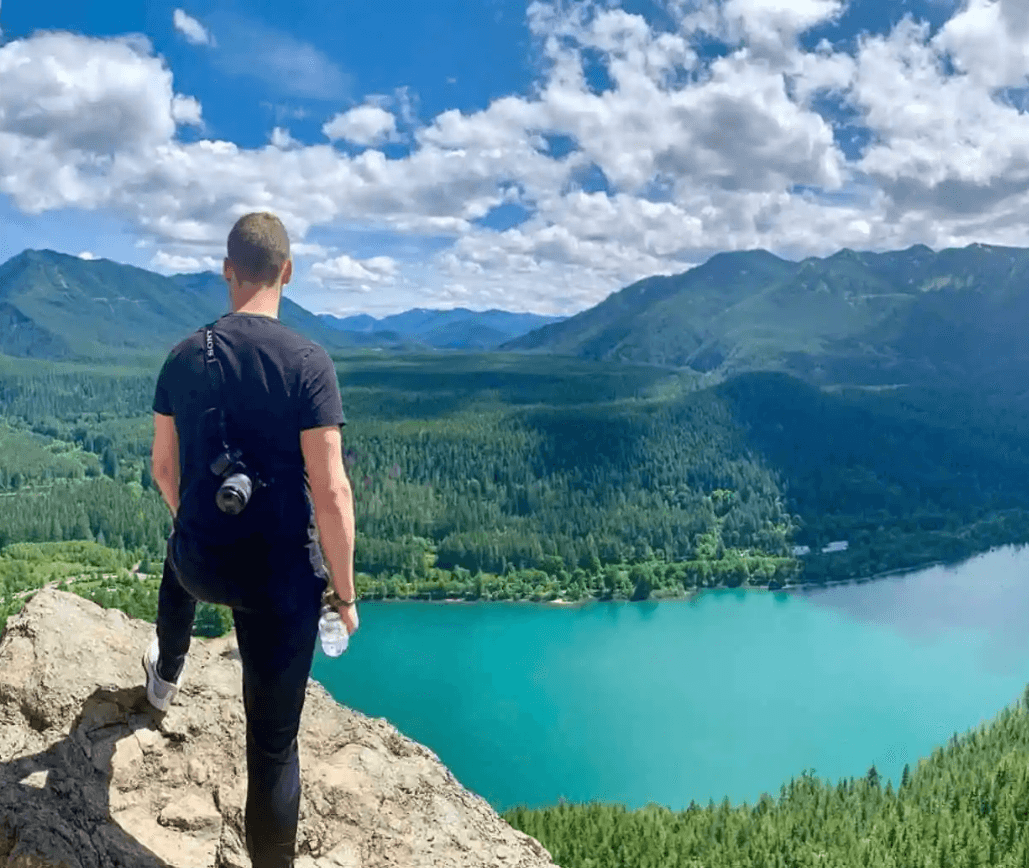
Seattle, Washington, is a city surrounded by lush forests, towering mountains, and stunning coastlines. It’s a paradise for hiking enthusiasts, offering trails that cater to all levels of experience. From short urban paths to challenging mountain treks, the Emerald City has it all.
Why Seattle is a Hiker’s Dream
Seattle’s unique geography makes it an ideal destination for hiking. The city is located near both the Cascade and Olympic mountain ranges, offering access to some of the most scenic trails in the Pacific Northwest. Whether you’re a seasoned hiker or a beginner looking for easy hikes in Seattle, there’s something for everyone. Let’s dive into some of the best hiking spots near Seattle.
1. Rattlesnake Ledge
Rattlesnake Trail is a popular hiking destination. It is uncovered near North Bend and is only 40 minutes from Seattle. This somewhat challenging 4-mile round-trip hike segments well-maintained trails. It will slowly rise to the edge as it winds via the dense forest. At the summit, hikers can enjoy spectacular panoramic vistas of Rattlesnake Lake, the surrounding mountain range, and the Snoqualmie Valley. The course’s accessibility and scenic looks make it a favorite among citizens and visitors. It will suit hikers of various skill levels. Best Zipline spots in Seattle, WA.
How to get there
Rattlesnake Ledge is about a 40-minute drive east of Seattle, near North Bend. The trailhead is right next to Rattlesnake Lake, and there is a lot of parking available. The parking lot can get crowded especially on weekends and sunny days. So I recommend to arrive early if you want to secure a good spot.
Trail’s basic information
The Rattlesnake Ledge Trail is a 4-mile round trip. It’s a straightforward out-and-back trail, so you won’t need to worry about getting lost or taking the wrong turn. It’s well-marked and maintained, and you will see lots of people around. The total height rise is about 1,160 feet, which means the trail has some decent incline, but it’s easy even if you’re beginner.
Best time to hike
Rattlesnake Ledge is accessible year-round, but the best time to hike is from spring to fall. In the winter, the trail can get snowy and icy, especially near the top, so if you’re planning to hike during colder months, be sure to check trail conditions and bring proper gear like microspikes.
If you’re like me and prefer fewer crowds, weekday mornings are the best time to go. On weekends, the trail can get packed, especially during peak hiking season.
2. Mount Si
One favorite hiking site is Mount Si, only forty-five minutes from Seattle, North Bend, and Washington. This demanding 8-mile round-trip hike is famous among professional hikers due to its steep, rough terrain and better than 3,000 feet of height gain. The trail will go through forests of towering evergreen trees. Which gives a glimpse of nature and the natural beauty of the surroundings. When comparing the peak, hikers are rewarded with stunning views of Mount Rainier, the expansive Cascade Mountains, and the Snoqualmie Valley. Because of its content difficulties and beautiful surroundings, Mount Si is an excellent goal for adventurers, offering a compelling experience. Learn about best camping spots near Seattle.
How to get there
Mount Si is located near the town of North Bend, about a 45-minute drive from downtown Seattle. The trailhead is easy to find with GPS and there is a large parking lot at the base. You’ll need a Discover Pass to park, which you can purchase ahead of time online or at the trailhead.. The parking lot fills up fast, especially on weekends, I’d recommend getting there early, preferably before 8 AM, to secure a spot.
Trail’s basic information
The Mount Si trail is about 8 miles round trip, with a significant height rise of 3,150 feet. It’s classified as a difficult hike, and it lives up to that reputation. The first time I did this hike, I had no idea how relentless the incline would feel, but it’s manageable with some patience and planning.
The trail starts in the forest and stays in the woods for most of the hike. It’s a steady uphill climb, with few flat sections to give your legs a break. I remember thinking to myself, “Just keep going,” as the switchbacks seemed never-ending. But the beauty of the forest keeps you distracted, with tall trees and plants lining the trail.
Despite the challenge, the trail is well-maintained and easy to follow. It’s a straightforward path without any confusing forks, so you won’t have to worry about getting lost. Also know about best bungee jumping places in Seattle, WA
Best time to hike
Mount Si is hikeable year-round, but the conditions vary quite a bit depending on the season. In the summer, the trail is dry and the temperatures are warm, but it can be crowded. In the fall, the trail cools down and the leaves change, making it a nice time to hike. Winter brings snow and ice, especially near the top, so if you’re hiking in winter, be sure to bring extra layers and traction gear like microspikes or crampons. Spring can be a bit muddy as the snow melts, but it’s still a good time to hike if you don’t mind a little mess.
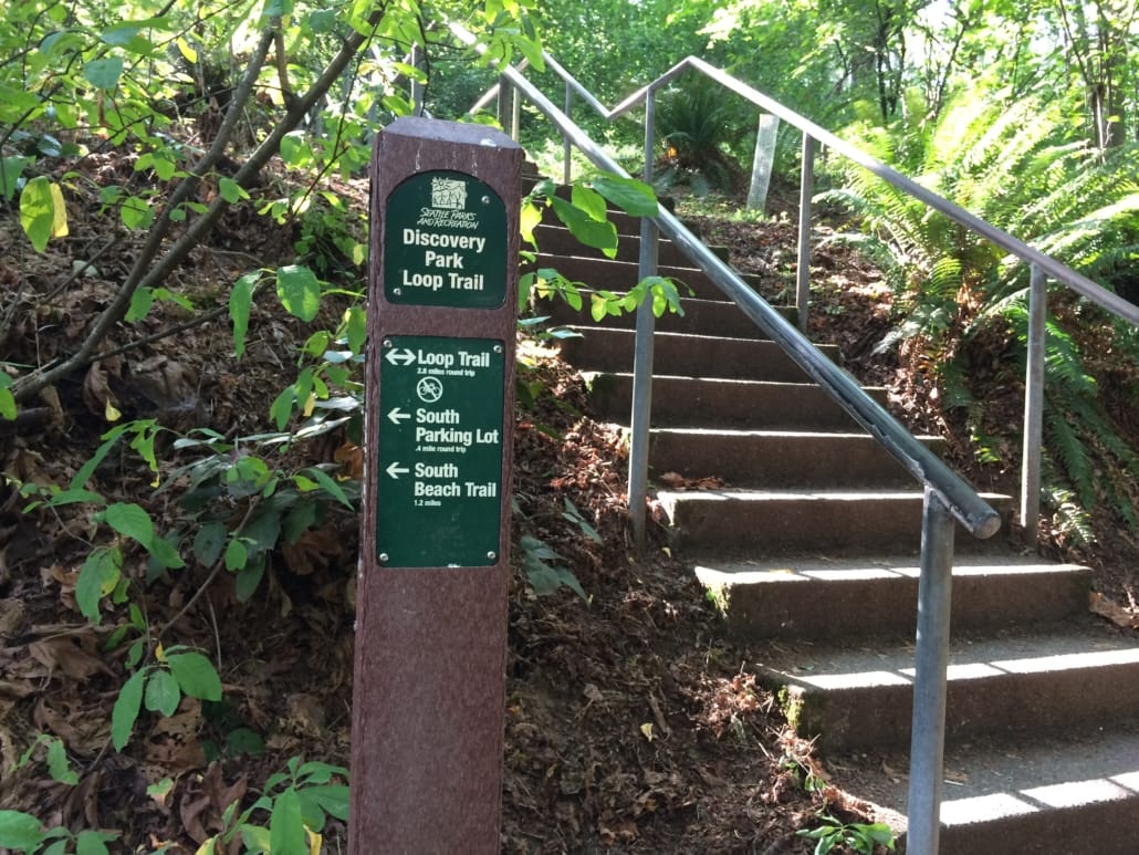
3. Discovery Park Loop Trail
Discovery Park Loop Trail is Seattle’s biggest park. It offers a quiet 2.8-mile hike. It will showcase a variety of Pacific Northwest topography. Its dense forests, open grasslands, and sandy beaches will attract tourists. As a result, as you hike, you’ll get stunning views of Puget Sound, the snow-capped Olympic Mountains, and even peeks of the city skyline. The trail is well maintained. Making it ideal for a quick urban getaway into nature. Wildlife like eagles, herons, and a few seals can be seen. Which will add appeal to the trail for nature fans. Best place for bungee jumping in Seattle, Washington
How to get there
Discovery Park is located in the northwest part of Seattle. It’s pretty easy to get to whether you’re driving or using public transportation. There is a parking lot near the visitor center, and if you are lucky, you can grab a spot there. Otherwise, there is some street parking nearby, but it can fill up quickly, especially on weekends. The park is open year round, and it’s free to visit.
Trail’s basic information
The Discovery Park Loop Trail is a 2.8-mile loop that circles through various parts of the park. It’s a relatively flat hike with a few gentle inclines, so it’s pretty manageable for most people. The trail is well marked with signs at each major intersection. Since it’s a loop, you won’t have to worry about getting lost.
Keep in mind one thing that the park has a few different trail systems. So if you want to add on extra mileage or visit the beach, there are additional trails you can take.
Best time to hike
Discovery Park is open year-round, and each season offers a different experience. In spring and summer, the meadows are lush and full of wildflowers, and you’re more likely to get clear views of the mountains. Fall brings beautiful foliage, especially in the forested sections of the trail. Even winter has its charm, with fewer people around and a peaceful, almost solitary feel to the park.
That said, my favorite time to visit is in the late afternoon or early evening. The light is softer, and if you time it right, you can catch the sunset over Puget Sound. It’s one of those moments where the city feels miles away, even though you’re still in it.
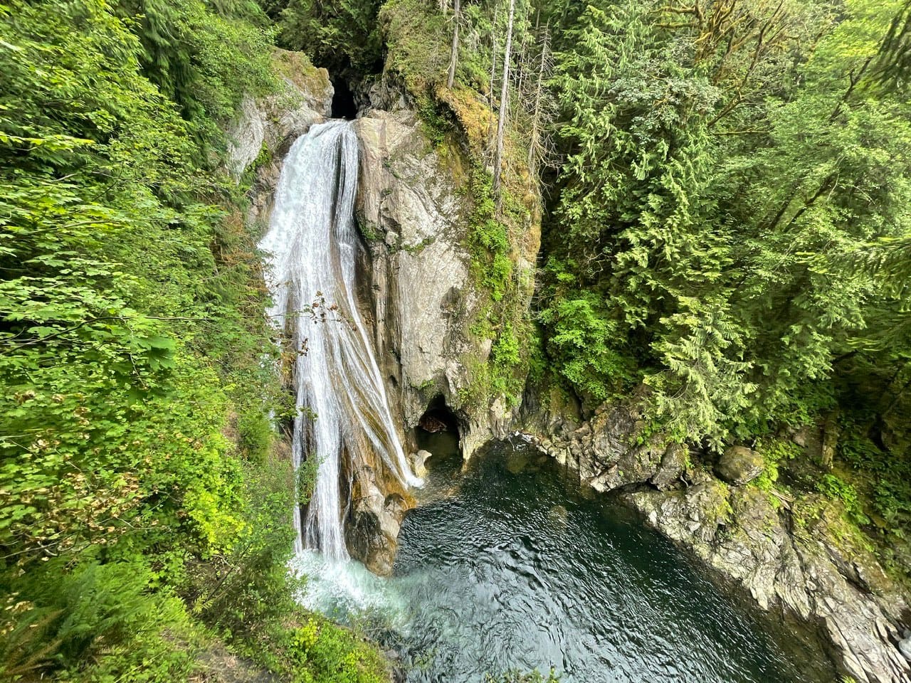
4. Twin Falls Trail
If you’re looking for short hikes near Seattle WA, Twin Falls is a fantastic choice. This 3.6-mile round-trip trail takes you through a lush forest and along the South Fork Snoqualmie River, leading to a stunning waterfall.
How to get there
The trailhead is about a 45-minute drive from Seattle. You’ll need to take I-90 and exit at 34. Follow the signs to Twin Falls and you’ll find the parking lot off SE 159th Street. There’s a sign at the entrance, so it’s easy to spot. You will need a Discover Pass to park here, and there’s usually enough space on weekdays, but it gets busier on weekends. If the lot fills up, you can park along the road, but that may add a short walk to the start of your hike.
Trail’s basic information
The trail is about 3 miles round trip, making it a good choice if you’re looking for a quick hike. It’s an out-and-back trail, so you’ll hike to the falls and then return the same way. The total elevation gain is around 500 feet. The trail is well-maintained and easy to follow, but it does have a few steep sections along the way.
Best time to hike
The trail is open year-round, but it’s best in spring when the waterfall is at its fullest. In summer, the trail is dry and well shaded, which makes it a nice option on hot days. Fall is also a great time to go, with cooler weather and colorful leaves. In winter, snow can sometimes make the trail icy, especially in the upper sections, so check trail conditions before heading out.
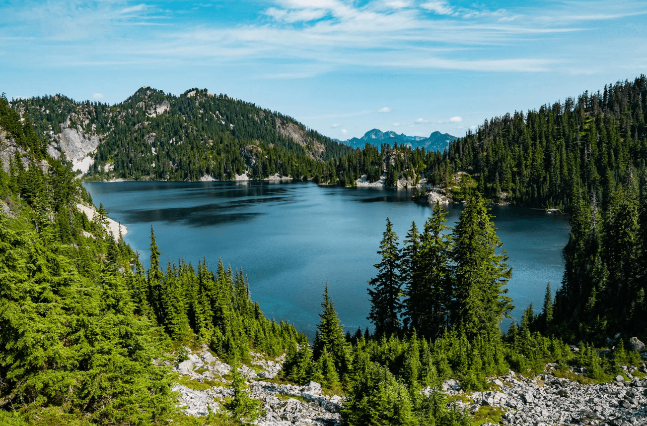
5. Snow Lake Trail
Snow Lake Trail is a famous 7.2-mile round-trip hike in the Snoqualmie Pass area. Found about an hour from Seattle. It takes hikers via dense forests across rocky terrain. There are panoramic views of the surrounding Cascade Mountains. Upon driving to Snow Lake, hikers will see crystal-clear blue water with towering peaks. The serene environment of the lake will allow for summer sports such as swimming, fishing, or resting by the water.
How to get there
The trailhead is located at the Alpental Ski Area, near Snoqualmie Pass. It’s about 55 miles from Seattle, and you’ll take I-90 east to Exit 52. Once you exit, follow signs to Alpental, and you’ll find a large parking lot at the end of the road. The lot can fill up fast, especially on weekends. Getting there early or carpooling is a good idea. A Northwest Forest Pass is required to park, so make sure to bring that.
Trail’s basic information
Snow Lake Trail is about 7.2 miles round trip. The total elevation gain is around 1,800 feet, so it’s a moderate hike. The trail starts with a steady climb through a forest, with some rocky sections. It follows a well-marked path that gets steeper as you go. After about 2 miles, you’ll reach the saddle, the highest point of the hike.
From the saddle, you get your first view of Snow Lake down below. After that, the trail descends toward the lake. The descent can be rocky and a little tricky, so take your time. Once you reach the lake, there are several spots along the shore where you can sit, relax, and enjoy the view. The trail follows the lake for a bit if you want to explore more of the shoreline. It typically takes around 2 to 3 hours to reach the lake, depending on your pace.
Best time to hike
The best time to hike Snow Lake is from late June to October. In early summer, snow may still cover parts of the trail, making it slippery. By mid-summer, the trail is usually clear, but it can still get cool near the lake. In fall, the colors are beautiful, but temperatures drop quickly. In winter, the trail is covered in snow and becomes more of a snowshoe route.